M
0

Spatial Analysis And Geospatial Data Science With Python
Last updated 7/2020
MP4 | Video: h264, 1280x720 | Audio: AAC, 44.1 KHz
Language: English | Size: 1.58 GB | Duration: 2h 13m
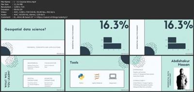
Learn how to process and visualize geospatial data and perform spatial analysis using Python.
Last updated 7/2020
MP4 | Video: h264, 1280x720 | Audio: AAC, 44.1 KHz
Language: English | Size: 1.58 GB | Duration: 2h 13m
Learn how to process and visualize geospatial data and perform spatial analysis using Python.
What you'll learn
The course introduces you to the most essential Geopython Libraries
Learn how to visualize Geospatial data in Python (static and interactive maps)
Perform Spatial Data analysis with Python
Learn how to pre-process geospatial data.
Learn the essentials of Geopandas Library, the workhorse of Geospatial data science in Python.
Perform Geocoding and Reverse Geocoding using free Open source Solutions.
Unleash the power of Locational analytics in Data science.
Reinforce your knowledge with Geospatial data science Excercises and Projects.
Requirements
Basic Understanding of Python
No GIS knowledge is required. We will give breif theoretical explanation.
You'll need to install Anaconda and GeoPython libraries. We will provide a Guide on installation and Jupyter Notebooks
Description
Geospatial data science is a subset of data science that focuses on spatial data and its unique techniques. It is beyond creating maps and merely focusing on where things happen but instead incorporates spatial analysis and insights derived from spatial data. In this course, we lay the foundation for a career in Geospatial Data Science. You will get introduced with Geopandas, the workhorse of Geospatial data science Python libraries.The topics covered in this course widely touch on some of the most used spatial technique in Geospatial data science. We will be learning how to read spatial data effectively, manipulate and process spatial data, and carry out spatial operations. A large portion of the course deals with spatial operations like Buffer analysis, Spatial joins and Nearest Neighbourhood analysis. Each video contains a brief overview of the topic and a walkthrough with code examples. We conclude each section Geospatial data science assignment and project, that will help you learn more effectively.We will also cover spatial data visualization using both Geopandasa and other interactive libraries like Folium, IpyLeaflet and Plotly Express. We cover how to make stunning Geo visualization for the most widely used map types.The final section covers some advance features including Geocoding, reverse geocoding, accessing OpenStreetMap data in Python and some advanced tips and tricks to process large Geospatial datasets.At the end of this course, you will be able to perform most of Geospatial data science operations in Python and also build a strong foundational knowledge in Geospatial Python.
Overview
Section 1: Introduction
Lecture 1 1.1 Course Intro
Lecture 2 1.2 Introduction
Lecture 3 1.3 - Jupyter Noteobok
Lecture 4 1.4 Introduction to Python
Lecture 5 1.5 Pandas Essentials - Part 1
Lecture 6 1.6 Pandas Essentials - Part 2
Section 2: Introduction to Geopandas
Lecture 7 2.1 Introduction
Lecture 8 2.2 - Reading Spatial Data
Lecture 9 2.3 - Read CSV File
Lecture 10 Read Subset data
Lecture 11 Geodataframe & Geoseries
Lecture 12 Coordinate Reference System (CRS)
Lecture 13 2.7 - Assignment
Section 3: Spatial Operations
Lecture 14 3.1 - Introduction
Lecture 15 3.2 - Spatial Join
Lecture 16 3.3 - Buffer Analysis
Lecture 17 3.4 - Overlay Analysis
Lecture 18 3.5 - Nearest Neighbourhood Analysis
Lecture 19 3.6 - Assignment
Section 4: Geospatial Data visualization (Geopandas)
Lecture 20 4.1 - Introduction
Lecture 21 4.2 Geovisualization basics
Lecture 22 4.3 Multi layer maps
Lecture 23 4.4 Choropleth Map
Lecture 24 4.5 Bubble Map
Lecture 25 4.6 Assignment
Section 5: Interactive Geospatial Data visualization
Lecture 26 5.1 - Introduction
Lecture 27 5.2 - Folium Part 1
Lecture 28 5.3 - Folium Part 2
Lecture 29 5.4 - IpyLeaflet
Lecture 30 5.5 - Plotly Express
Lecture 31 5.6 - Assignment
Section 6: Advanced Operations
Lecture 32 6.1 Introduction
Lecture 33 6.2 - Geocoding
Lecture 34 6.3 - Reverse Geocoding
Lecture 35 6.4 - Retrieve Openstreetmap data
Lecture 36 6.5 - Tips to speed up Geospatial processing
Students who want to learn Python for Geospatial Data Science.,Students who like to take their first steps in the Geospatial data science career.,Python users who are interested in Spatial Data Science.,GIS users who are new to python and Jupyter notebooks for Geographic data analysis.

Download link
rapidgator.net:
You must reply in thread to view hidden text.
uploadgig.com:
You must reply in thread to view hidden text.
nitroflare.com:
You must reply in thread to view hidden text.
1dl.net:
You must reply in thread to view hidden text.
