M
0
Learn The Basics Of Arcgis For Hydrology
Last updated 5/2018
MP4 | Video: h264, 1280x720 | Audio: AAC, 44.1 KHz
Language: English | Size: 2.29 GB | Duration: 3h 24m
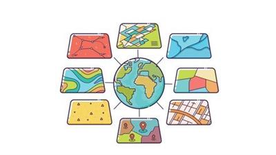
Learn the basics of the main GIS software on the market and how to use it for hydrology analysis
Last updated 5/2018
MP4 | Video: h264, 1280x720 | Audio: AAC, 44.1 KHz
Language: English | Size: 2.29 GB | Duration: 3h 24m
Learn the basics of the main GIS software on the market and how to use it for hydrology analysis
What you'll learn
Students will be able to understand ArcGIS concepts
Students will be able to perform basic and advanced processing actions in ArcGIS
Students will be able to represent their analysis on a map
Students will be able to make a map from start to finish
Requirements
You need to know how to use Windows software
You need to own a computer
You need to have ArcGIS software on your computer
Description
This course will take you from a beginner in ArcGIS, from downloading data, to performing basic functions. Alonso will teach you the basic concepts, how to perform the main features in the GIS software, use the geoprocessing tools, how to export to AutoCAD, while on the hydrology side Konrad will teach you how to perform hydrology related tasks such as Calculate Flow Direction And Flow Accumulation, Watershed Delineation, Stream Segments And Catchments, Spatial Join To Catchments as well as map layout with elements.Work side-by-side with the presentation and feel free to ask questions when you don't understand something. This tool is highly looked after in the hydrological field.Teachers: Alonso Gonzalez - GIS research assistant in Mexico Konrad Hafen - Spatial Modeler, Analyst & Scientist in USA
Overview
Section 1: Introduction to ArcGIS software
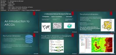
Lecture 1 Introduction to GIS
Lecture 2 Introduction to ArcGIS software
Lecture 3 Selection by Location, attributes, clip features and tables to Excel
Lecture 4 Performing actions on the data: change the projections, dissolve, clip
Lecture 5 From .TXT and .DXF to shapefile
Lecture 6 Calculations with attribute table and KML files in ArcMap
Lecture 7 Export from ArcMap to PDF
Lecture 8 ArcScene 3D
Lecture 9 GIS Example Test
Lecture 10 AutoCAD fixing polygon coordinates
Section 2: ArcGIS for Hydrology
Lecture 11 Download hydrological data
Lecture 12 Calculate flow direction and flow accumulation
Lecture 13 Watershed delineation
Lecture 14 Clip layers to watershed boundary
Lecture 15 Stream segments and catchments areas
Lecture 16 Stream order convert to vector
Lecture 17 Spatial join to catchments
Lecture 18 Join stream id to stream order
Lecture 19 Map data and initial layout
Lecture 20 Add and format map elements
Beginners in GIS,Hydrology technicians,GIS students,GIS entrepreneurs,ArcGIS students
Download link
rapidgator.net:
You must reply in thread to view hidden text.
uploadgig.com:
You must reply in thread to view hidden text.
nitroflare.com:
You must reply in thread to view hidden text.
1dl.net:
You must reply in thread to view hidden text.
")